

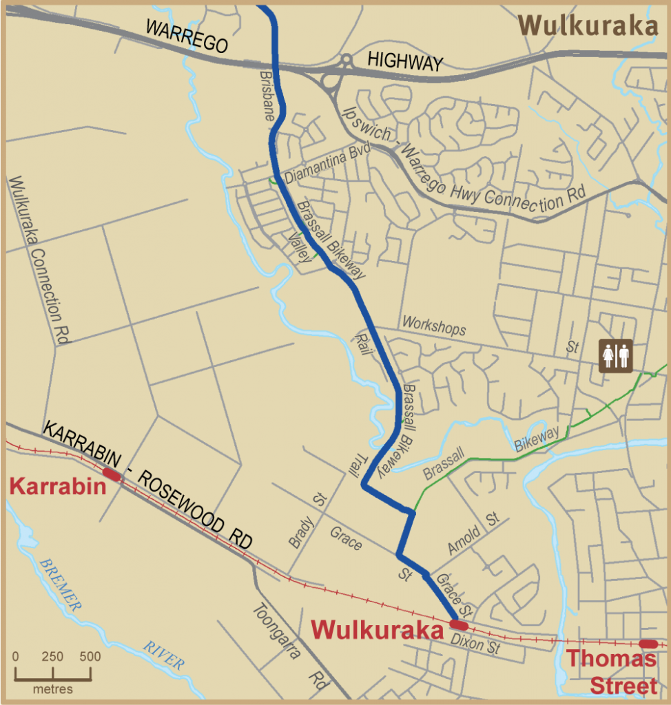
Wulkuraka to Fernvale
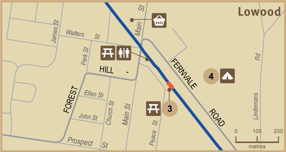
Fernvale to Lowood

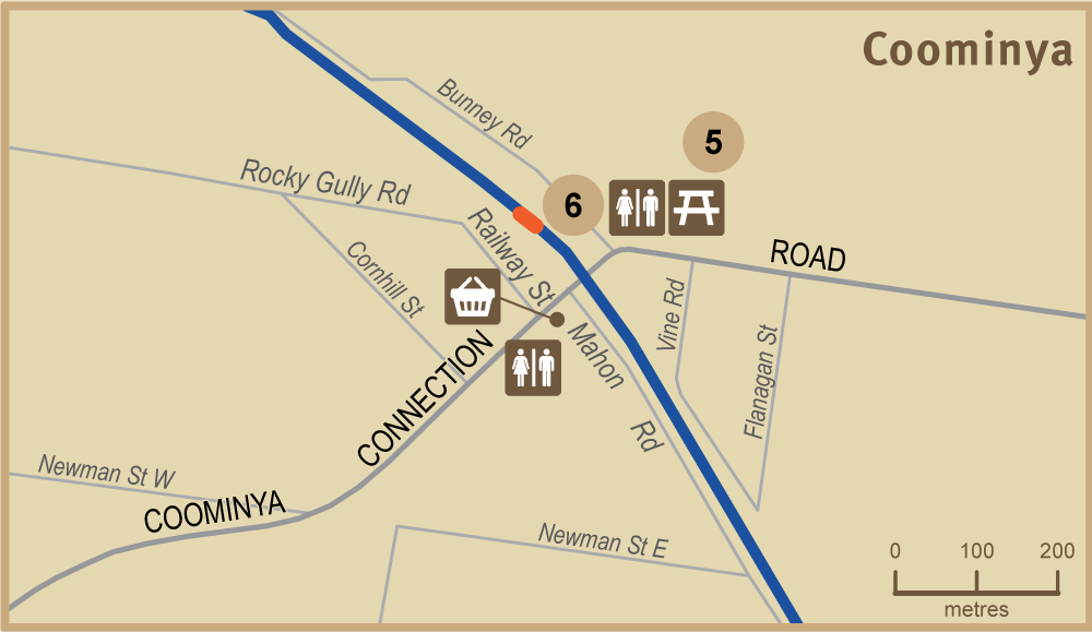
Lowood to Coominya
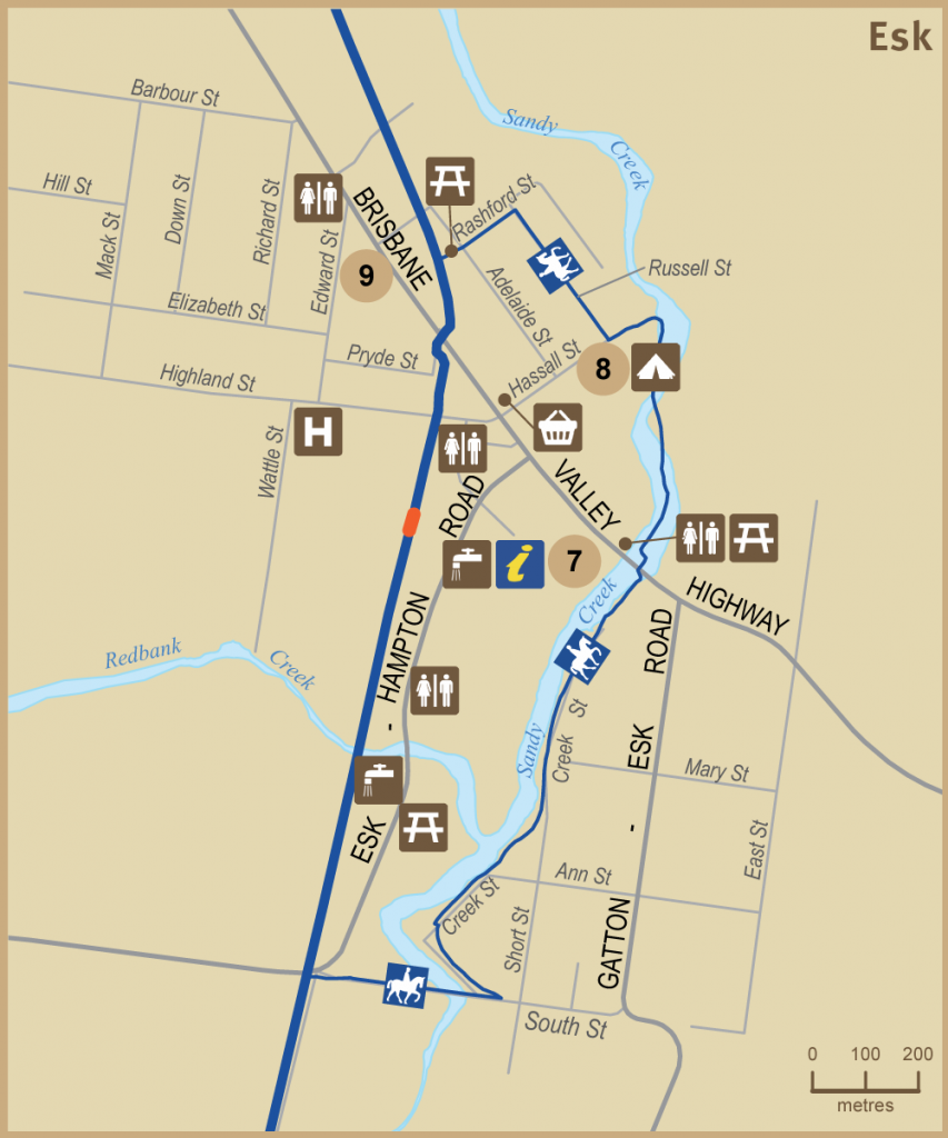
Coominya to Esk
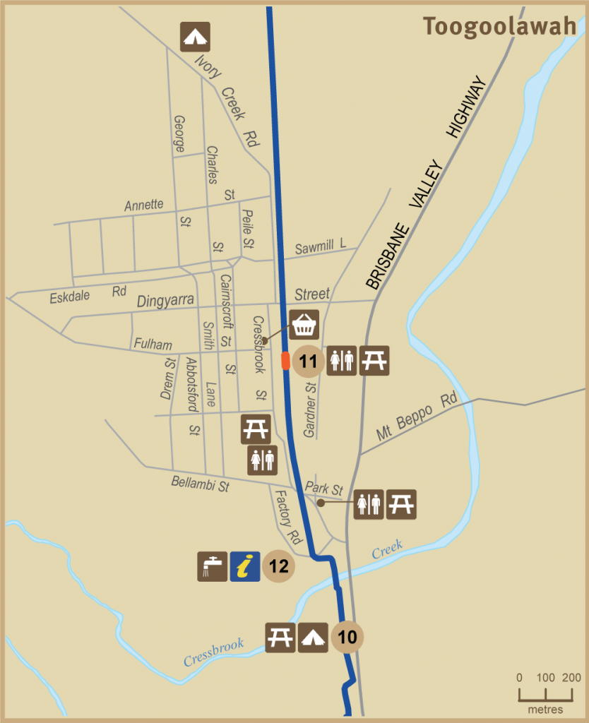
Esk to Toogoolawah
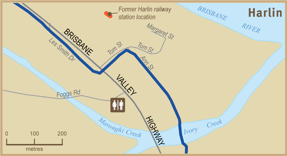
Toogoolawah to Harlin
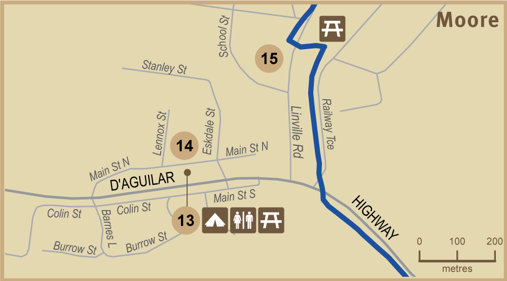
Harlin to Moore
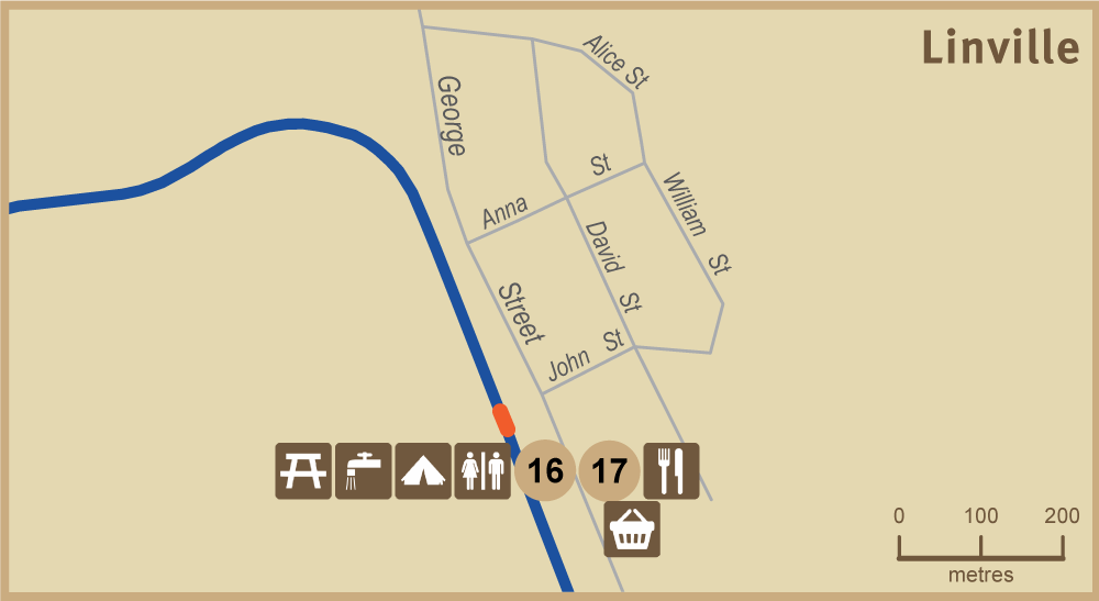
Moore to Linville
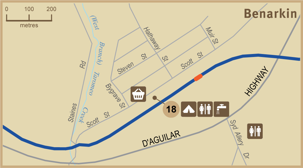
Linville to Benarkin
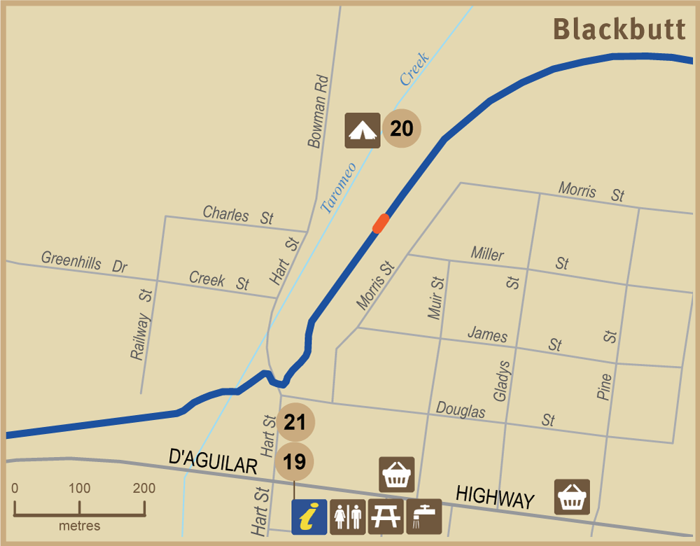
Benarkin to Blackbutt
Blackbutt to Yarraman
Yarraman